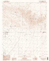
1988 Map of Chuckwalla Spring
USGS Topo · Published 1988About this map
Chuckwalla Spring and Mesquite Spring serve as critical water points in this arid stretch of the California desert, where the Chuckwalla Mountains meet the Little Chuckwalla Mountains. This late-1980s landscape is defined by its isolation and specialized land use, as indicated by the presence of a Mine and various Prospects in the northern canyons. To the south, the terrain drops toward the broad Arroyo Seco, a prominent drainage feature that cuts across the territory.
Find a feature on this map
17 named features on this map. Tap any name to fly to it.
Don’t see what you’re looking for? This feature index may not catch every label — zoom into the map to look around manually.
Map Details
Editions of this 1988 Chuckwalla Spring Map
2 editions found
Other maps of this area

1940 · Iris Pass
USGS Topo · 1:62,500

1944 · Chuckwalla Mountains
USGS Topo · 1:62,500

1945 · Iris Pass
USGS Topo · 1:62,500

1952 · Sidewinder Well
USGS Topo · 1:62,500

1953 · Chuckwalla Spring
USGS Topo · 1:62,500

1954 · Salton Sea
USGS Topo · 1:250,000

1955 · Salton Sea
USGS Topo · 1:250,000

1959 · Salton Sea
USGS Topo · 1:250,000

1963 · Salton Sea
USGS Topo · 1:250,000
1963 · Iris Pass
USGS Topo · 1:62,500