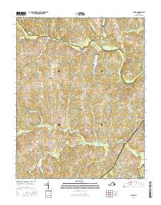
2016 Map of Chula
USGS Topo · Published 2016About this map
The Appomattox River carves a winding path along the northern reaches of Amelia County, serving as the primary geographic anchor for this rural Virginia landscape. Small settlements and local landmarks dot the terrain, from Giles Bridge in the northwest to the community of Chula in the southeast. The interior is defined by a network of drainage basins, including Flat Cr and Nibbs Cr, which frame scattered residential pockets like Fieldstown and Elk Hill.
Find a feature on this map
68 named features on this map. Tap any name to fly to it.
Don’t see what you’re looking for? This feature index may not catch every label — zoom into the map to look around manually.
Map Details
Editions of this 2016 Chula Map
This is the sole edition of this map. No revisions or reprints were ever made.
Other maps of this area

1890 · Goochland
USGS Topo · 1:125,000

1891 · Palmyra
USGS Topo · 1:125,000

1891 · Farmville
USGS Topo · 1:125,000

1892 · Goochland
USGS Topo · 1:125,000

1893 · Farmville
USGS Topo · 1:125,000

1895 · Palmyra
USGS Topo · 1:125,000

1897 · Amelia
USGS Topo · 1:125,000

1897 · Palmyra
USGS Topo · 1:125,000

1943 · Fine Creek Mills
USGS Topo · 1:31,680

1943 · Powhatan
USGS Topo · 1:31,680