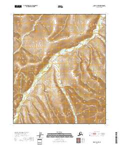
2018 Map of Circle A-3 NW
USGS Topo · Published 2018About this map
Clums Fork meanders through the heart of this Yukon-Koyukuk interior landscape, defining a complex drainage system that reveals the subtle hydrography of the Alaskan wilderness. The terrain is characterized by a series of tributary streams including Acme Cr and Bear Cr, which provide a clear picture of the natural water flow across the township boundaries of T5N R11E and T4N R12E. In the northeast, Dexter Cr carves into the upland, while the southern reaches are marked by the presence of Volcano Cr. This survey illustrates the undeveloped character of the region as it existed in the early 21st century, offering a baseline for researchers interested in environmental shifts and local drainage patterns in the Circle A-3 NW quadrangle.
Find a feature on this map
9 named features on this map. Tap any name to fly to it.
Don’t see what you’re looking for? This feature index may not catch every label — zoom into the map to look around manually.
Map Details
Editions of this 2018 Circle A-3 NW Map
This is the sole edition of this map. No revisions or reprints were ever made.
Other maps of this area

1951 · Circle
USGS Topo · 1:250,000

1952 · Circle A-4
USGS Topo · 1:63,360

1952 · Circle B-4
USGS Topo · 1:63,360

1955 · Circle B-3
USGS Topo · 1:63,360

1955 · Circle A-3
USGS Topo · 1:63,360

1955 · Circle
USGS Topo · 1:250,000

1964 · Circle
USGS Topo · 1:250,000
2018 · Circle A-3 NE
USGS Topo · 1:25,000
2018 · Circle A-4 NE
USGS Topo · 1:25,000
2018 · Circle B-3 SW
USGS Topo · 1:25,000