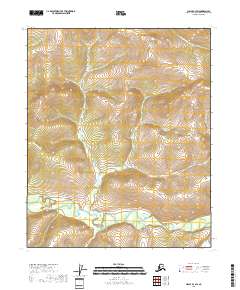
2018 Map of Circle B-3 SW
USGS Topo · Published 2018About this map
Birch Creek winds through the southern landscape of this Yukon-Koyukuk region, creating a complex network of wetlands and oxbows at the base of rising uplands. This 2018 survey illustrates the intricate drainage patterns of the Alaskan interior, where numerous tributaries including Annie Cr and the aptly named Great Unknown Cr descend from higher elevations. To the northeast, the terrain is defined by the S Fork Harrison Cr drainage, while Butte Cr and Clums Fork mark the northwestern and southeastern reaches of the quadrangle. The map highlights the vast, unpopulated character of the Alaskan wilderness, showing no permanent settlements or roads, only the natural progression of water through the valley systems of the Arctic Circle region.
Find a feature on this map
10 named features on this map. Tap any name to fly to it.
Don’t see what you’re looking for? This feature index may not catch every label — zoom into the map to look around manually.
Map Details
Editions of this 2018 Circle B-3 SW Map
This is the sole edition of this map. No revisions or reprints were ever made.
Other maps of this area

1951 · Circle
USGS Topo · 1:250,000

1952 · Circle A-4
USGS Topo · 1:63,360

1952 · Circle B-4
USGS Topo · 1:63,360

1955 · Circle B-3
USGS Topo · 1:63,360

1955 · Circle A-3
USGS Topo · 1:63,360

1955 · Circle
USGS Topo · 1:250,000

1964 · Circle
USGS Topo · 1:250,000
2018 · Circle A-3 NE
USGS Topo · 1:25,000
2018 · Circle A-4 NE
USGS Topo · 1:25,000
2018 · Circle B-4 NE
USGS Topo · 1:25,000