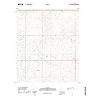
2018 Map of Circle A-6 SW
USGS Topo · Published 2018About this map
The Little Chena River winds extensively through this interior Alaskan wilderness, defining a landscape dominated by complex drainage systems and high-elevation terrain. This 2018 survey emphasizes the hydrological network of the Fairbanks North Star Borough, where numerous named tributaries converge to feed the larger river system. To the north and west, the map details the courses of Elliott Cr, Sorrels Cr, and Miller Cr, while the southeast corner is marked by the presence of Anaconda Cr. The map provides a contemporary view of these natural corridors within the Fairbanks North Star Borough boundaries, illustrating the township and range divisions such as t3n r4e and t4n r5e that partition this undeveloped expanse. The concentration of creek names like Bonanza Cr and Fish Cr indicates a region deeply tied to its water resources and physical geography.
Find a feature on this map
14 named features on this map. Tap any name to fly to it.
Don’t see what you’re looking for? This feature index may not catch every label — zoom into the map to look around manually.
Map Details
Editions of this 2018 Circle A-6 SW Map
This is the sole edition of this map. No revisions or reprints were ever made.
Other maps of this area

1945 · Livengood
USGS Topo · 1:250,000

1949 · Fairbanks D-1
USGS Topo · 1:62,500

1950 · Fairbanks
USGS Topo · 1:250,000

1950 · Big Delta
USGS Topo · 1:250,000

1950 · Big Delta D-6
USGS Topo · 1:63,360

1951 · Big Delta
USGS Topo · 1:250,000

1951 · Fairbanks
USGS Topo · 1:250,000

1951 · Livengood
USGS Topo · 1:250,000

1951 · Circle
USGS Topo · 1:250,000

1952 · Big Delta D-6
USGS Topo · 1:63,360