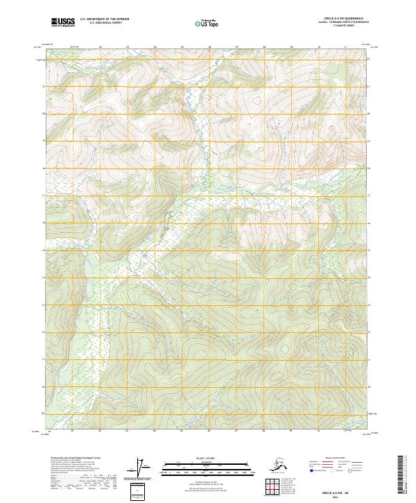
2024 Map of Circle A-6 SW
USGS Topo · Published 2024About this map
The Little Chena River winds through this interior Alaskan landscape, serving as the primary drainage for numerous tributaries within the Fairbanks North Star Borough. The terrain is defined by a dense network of waterways, including Elliott Creek and Sorrels Creek in the north, which flow through high-relief areas into the broader river valley. The map documents the intricate hydrology of the region as of 2024, showing how Miller Creek and Fish Creek intersect the central drainage basins. To the south, the headwaters of Caribou Creek and Anaconda Creek provide a look at the natural landscape before these waters eventually join larger systems downstream. This survey highlights the undeveloped character of this wilderness area, focusing on the natural watercourses and the established township and range boundaries of the Public Land Survey System.
Find a feature on this map
14 named features on this map. Tap any name to fly to it.
Don’t see what you’re looking for? This feature index may not catch every label — zoom into the map to look around manually.
Map Details
Editions of this 2024 Circle A-6 SW Map
This is the sole edition of this map. No revisions or reprints were ever made.
Other maps of this area

1945 · Livengood
USGS Topo · 1:250,000

1949 · Fairbanks D-1
USGS Topo · 1:62,500

1950 · Fairbanks
USGS Topo · 1:250,000

1950 · Big Delta
USGS Topo · 1:250,000

1950 · Big Delta D-6
USGS Topo · 1:63,360

1951 · Big Delta
USGS Topo · 1:250,000

1951 · Fairbanks
USGS Topo · 1:250,000

1951 · Livengood
USGS Topo · 1:250,000

1951 · Circle
USGS Topo · 1:250,000

1952 · Big Delta D-6
USGS Topo · 1:63,360