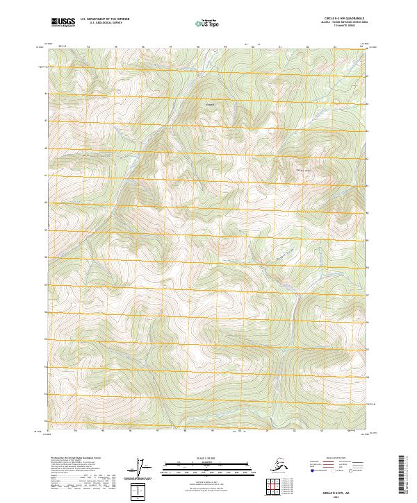
2023 Map of Circle B-2 NW
USGS Topo · Published 2023About this map
The settlement of Central occupies a high-elevation interior landscape dominated by the branching drainage basins of the Yukon-Koyukuk region. Gold-mining heritage is written into the nomenclature of the land, with features like Discovery Gulch, Nugget Gulch, and Half Dollar Creek suggesting the historic prospecting activity that defined this territory. Deadwood Creek Road provides the primary overland access through the complex network of ridges and narrow valleys, skirting the southern edge of the Steese National Conservation Area.
Find a feature on this map
34 named features on this map. Tap any name to fly to it.
Don’t see what you’re looking for? This feature index may not catch every label — zoom into the map to look around manually.
Map Details
Editions of this 2023 Circle B-2 NW Map
This is the sole edition of this map. No revisions or reprints were ever made.
Other maps of this area

1951 · Circle
USGS Topo · 1:250,000

1955 · Circle B-3
USGS Topo · 1:63,360

1955 · Circle C-3
USGS Topo · 1:63,360

1955 · Circle C-2
USGS Topo · 1:63,360

1955 · Circle B-2
USGS Topo · 1:63,360

1955 · Circle
USGS Topo · 1:250,000

1964 · Circle
USGS Topo · 1:250,000
2018 · Circle C-2 SE
USGS Topo · 1:25,000
2018 · Circle C-2 SW
USGS Topo · 1:25,000
2018 · Circle B-2 NW
USGS Topo · 1:25,000