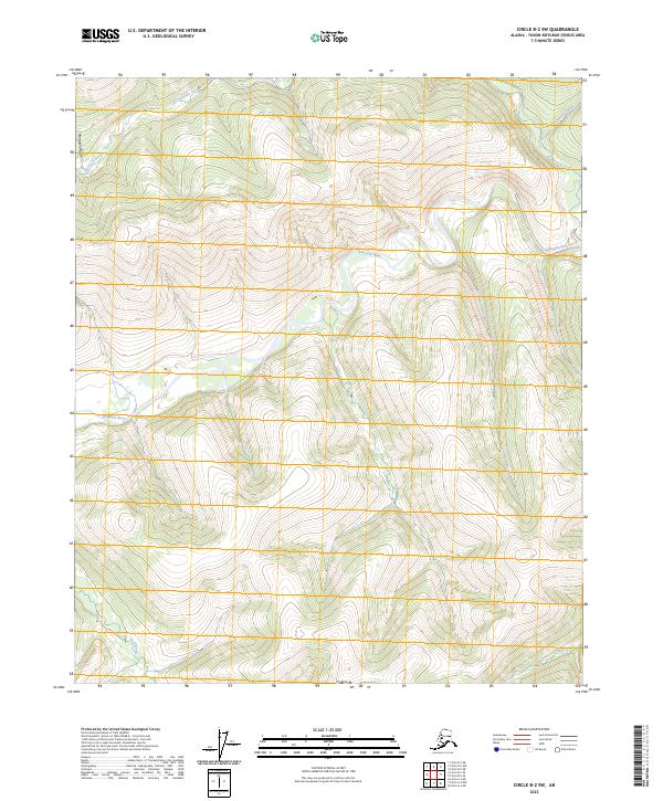
2023 Map of Circle B-2 SW
USGS Topo · Published 2023About this map
The Birch Creek Wild and Scenic River meanders through the heart of this interior Alaskan landscape, protected as part of the Steese National Conservation Area. This topography is defined by a dense network of high-elevation drainages, including Harrison Creek and its tributary Ptarmigan Gulch in the northwest, and Traverse Creek to the northeast. The southern portion of the quadrangle is marked by the headwaters of Wolf Creek and Sheep Creek, which flow through the high ridges of the Yukon-Koyukuk region. This 2023 survey provides a contemporary record of this wilderness corridor, highlighting the complex water systems like the Ikheenjik River that dictate the region's geography. The map illustrates a landscape largely devoid of human infrastructure, focusing instead on the hydrography and natural boundaries that define this conservation land.
Find a feature on this map
13 named features on this map. Tap any name to fly to it.
Don’t see what you’re looking for? This feature index may not catch every label — zoom into the map to look around manually.
Map Details
Editions of this 2023 Circle B-2 SW Map
This is the sole edition of this map. No revisions or reprints were ever made.
Other maps of this area

1951 · Circle
USGS Topo · 1:250,000

1955 · Circle B-3
USGS Topo · 1:63,360

1955 · Circle A-2
USGS Topo · 1:63,360

1955 · Circle A-3
USGS Topo · 1:63,360

1955 · Circle B-2
USGS Topo · 1:63,360

1955 · Circle
USGS Topo · 1:250,000

1964 · Circle
USGS Topo · 1:250,000
2018 · Circle B-2 NW
USGS Topo · 1:25,000
2018 · Circle A-2 NW
USGS Topo · 1:25,000
2018 · Circle A-2 NE
USGS Topo · 1:25,000