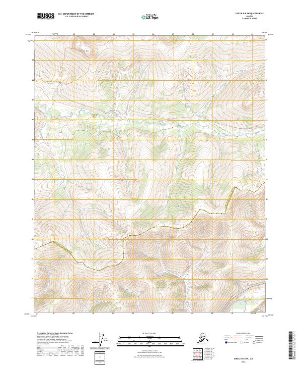
2024 Map of Circle B-6 SW
USGS Topo · Published 2024About this map
White Mountains National Recreation Area dominates the high country of this interior Alaskan landscape, characterized by the prominent summit of Table Top Mtn. The terrain is defined by a dense network of high-latitude drainage systems, where Nome Creek and Moose Creek flow through the northern reaches while the Chatanika River cuts across the southern corner. This area serves as a critical corridor for interior travel, with the Steese Expressway/Highway providing primary access through the river valley. The map reveals the boundary between the Yukon-Koyukuk Census Area and Fairbanks North Star Borough, a line that navigates the complex ridges and creek beds. Remote access routes like Nome Creek West Road track along the contours, connecting the backcountry watersheds of Ptarmigan Creek and Grouse Creek to the main thoroughfare.
Find a feature on this map
17 named features on this map. Tap any name to fly to it.
Don’t see what you’re looking for? This feature index may not catch every label — zoom into the map to look around manually.
Map Details
Editions of this 2024 Circle B-6 SW Map
This is the sole edition of this map. No revisions or reprints were ever made.
Other maps of this area

1945 · Livengood
USGS Topo · 1:250,000

1951 · Livengood
USGS Topo · 1:250,000

1951 · Circle
USGS Topo · 1:250,000

1952 · Livengood A-1
USGS Topo · 1:63,360

1954 · Circle A-6
USGS Topo · 1:63,360

1954 · Circle B-6
USGS Topo · 1:63,360

1954 · Livengood B-1
USGS Topo · 1:63,360
1954 · Livengood A-1
USGS Topo · 1:63,360

1955 · Circle
USGS Topo · 1:250,000

1956 · Livengood
USGS Topo · 1:250,000