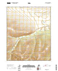
2018 Map of Circle C-3 SE
USGS Topo · Published 2018About this map
Miller House sits at the junction of the mountain-pass roads in this interior Alaskan landscape. This 2018 survey documents a region defined by its hydrography and creek-bottom developments, where Granite Gulch and the banks of Mammoth Cr meet a network of primitive routes including Harrison Creek Road and Miller Creek Road. The naming conventions throughout the quadrangle, such as Mastodon Cr, Stack Pup, and Sawpit Cr, reflect the mining and prospecting heritage of the Yukon-Koyukuk region.
Find a feature on this map
20 named features on this map. Tap any name to fly to it.
Don’t see what you’re looking for? This feature index may not catch every label — zoom into the map to look around manually.
Map Details
Editions of this 2018 Circle C-3 SE Map
This is the sole edition of this map. No revisions or reprints were ever made.
Other maps of this area

1951 · Circle
USGS Topo · 1:250,000

1955 · Circle B-3
USGS Topo · 1:63,360

1955 · Circle C-3
USGS Topo · 1:63,360

1955 · Circle C-2
USGS Topo · 1:63,360

1955 · Circle B-2
USGS Topo · 1:63,360

1955 · Circle
USGS Topo · 1:250,000

1964 · Circle
USGS Topo · 1:250,000
2018 · Circle C-2 SW
USGS Topo · 1:25,000
2018 · Circle B-2 NW
USGS Topo · 1:25,000
2018 · Circle C-3 NE
USGS Topo · 1:25,000