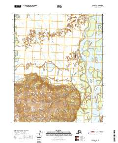
2018 Map of Circle D-1 SE
USGS Topo · Published 2018About this map
Circle sits at a critical bend in the Yukon River, serving as a long-standing northern terminus for road travel in this region. This 2018 survey illustrates the complex relationship between the settlement and the surrounding wetlands, where waterways like Sixmile Cr and Birch Creek thread through a landscape defined by seasonal changes and varying elevations. The presence of the Circle City Airport highlights the community's reliance on air transport for logistics and accessibility in the Interior. Away from the riverbank, the terrain rises into hills, while low-lying areas are dotted with features like Fiasco Lake, indicating the dynamic hydrology typical of the Yukon-Koyukuk area.
Find a feature on this map
10 named features on this map. Tap any name to fly to it.
Don’t see what you’re looking for? This feature index may not catch every label — zoom into the map to look around manually.
Map Details
Editions of this 2018 Circle D-1 SE Map
This is the sole edition of this map. No revisions or reprints were ever made.
Other maps of this area

1951 · Charley River
USGS Topo · 1:250,000

1951 · Circle
USGS Topo · 1:250,000

1955 · Circle D-1
USGS Topo · 1:63,360

1955 · Circle C-1
USGS Topo · 1:63,360

1955 · Circle
USGS Topo · 1:250,000

1956 · Charley River C-6
USGS Topo · 1:63,360
1956 · Charley River D-6
USGS Topo · 1:63,360

1956 · Charley River
USGS Topo · 1:250,000

1964 · Circle
USGS Topo · 1:250,000
2018 · Circle C-1 NW
USGS Topo · 1:25,000