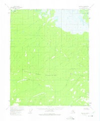
1952 Map of Circle D-2
USGS Topo · Published 1975About this map
The Little Crazy Mountains dominate the central topography of this interior Alaska region, marking a transition between high-elevation ridges and the marshy lowlands of the north. This mid-century survey reveals a landscape largely devoid of permanent development, save for a single isolated Cabin situated near the edge of a massive expanse of muskeg and wetlands. These northern flats are drained by intricate water systems, including the headwaters of Birch and the braided path of Preacher Cr. To the south, the terrain becomes more defined as the elevations rise into the mountains, with Big Creek carving a distinct valley through the southern half of the quadrangle. The map reflects a period of surveying based on early 1950s aerial photography, documenting a remote wilderness area before later shifts in land management and access changed the character of the Alaskan interior.
Find a feature on this map
6 named features on this map. Tap any name to fly to it.
Don’t see what you’re looking for? This feature index may not catch every label — zoom into the map to look around manually.
Map Details
Editions of this 1952 Circle D-2 Map
3 editions found
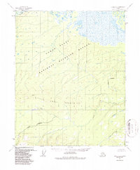
Other maps of this area

1951 · Fort Yukon
USGS Topo · 1:250,000

1951 · Circle
USGS Topo · 1:250,000

1952 · Circle D-3
USGS Topo · 1:63,360

1952 · Circle D-2
USGS Topo · 1:63,360

1955 · Circle C-3
USGS Topo · 1:63,360

1955 · Circle C-2
USGS Topo · 1:63,360

1955 · Circle D-1
USGS Topo · 1:63,360

1955 · Circle C-1
USGS Topo · 1:63,360

1955 · Circle
USGS Topo · 1:250,000

1956 · Fort Yukon A-2
USGS Topo · 1:63,360