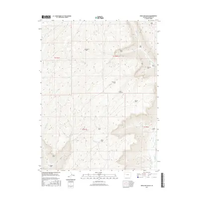
2016 Map of Circle Dot Gulch
USGS Topo · Published 2016About this map
Jackrabbit Ridge and Davis Point define the high country of Garfield County in this mid-2010s topographic study. The landscape is deeply incised by a series of drainages including Circle Dot Gulch, House Log Gulch, and Cascade Canyon, reflecting a complex network of seasonal runoff and erosion. Human modification of the arid environment is evident in the water management infrastructure, specifically the Jangle Ditch and Low Cost Ditch located near the southern edge of the quadrangle.
Find a feature on this map
31 named features on this map. Tap any name to fly to it.
Don’t see what you’re looking for? This feature index may not catch every label — zoom into the map to look around manually.
Map Details
Editions of this 2016 Circle Dot Gulch Map
This is the sole edition of this map. No revisions or reprints were ever made.
Other maps of this area

1925 · Parachute Creek
USGS Topo · 1:62,500

1927 · Parachute Creek
USGS Topo · 1:62,500

1929 · Grand Valley
USGS Topo · 1:62,500

1929 · Highmore
USGS Topo · 1:62,500

1929 · Roan Creek
USGS Topo · 1:62,500

1956 · Grand Junction
USGS Topo · 1:250,000

1959 · Grand Junction
USGS Topo · 1:250,000

1960 · Grand Junction
USGS Topo · 1:250,000

1962 · Grand Junction
USGS Topo · 1:250,000
1962 · Grand Valley
USGS Topo · 1:24,000