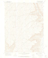
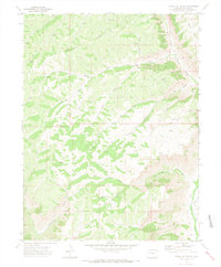
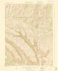
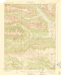
1971 Map of Circle Dot Gulch
USGS Topo · Published 1974About this map
Jackrabbit Ridge dominates the upper elevations of this Garfield County landscape, where a complex network of seasonal drainage and steep terrain defines the high country. In the early 1970s, this area remained largely remote, characterized by numerous gulches and canyons such as Garden Gulch, Corral Gulch, and Cascade Canyon. The map records a series of unnamed prospects and prospects, signaling the ongoing interest in the mineral and energy potential of the Piceance Basin's oil shale formations. Water sources are critical landmarks in this environment, with Parachute Creek and its West Fork providing primary drainage, while named springs and smaller tributaries like Wolf Creek and Bear Run are scattered throughout the draws. The prevalence of a Jeep Trail system indicates the limited, rugged access to these high plateaus before more modern infrastructure arrived.
Find a feature on this map
24 named features on this map. Tap any name to fly to it.
Don’t see what you’re looking for? This feature index may not catch every label — zoom into the map to look around manually.
Map Details
Editions of this 1971 Circle Dot Gulch Map
3 editions found

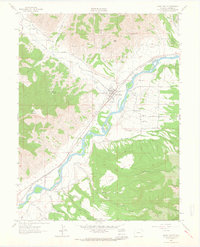
Other maps of this area

1925 · Parachute Creek
USGS Topo · 1:62,500
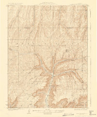
1927 · Parachute Creek
USGS Topo · 1:62,500
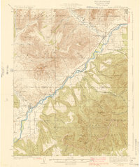
1929 · Grand Valley
USGS Topo · 1:62,500
1929 · Highmore
USGS Topo · 1:62,500
1929 · Roan Creek
USGS Topo · 1:62,500

1956 · Grand Junction
USGS Topo · 1:250,000

1959 · Grand Junction
USGS Topo · 1:250,000

1960 · Grand Junction
USGS Topo · 1:250,000

1962 · Grand Junction
USGS Topo · 1:250,000
1962 · Grand Valley
USGS Topo · 1:24,000