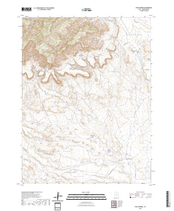
2023 Map of Cisco Springs
USGS Topo · Published 2023About this map
The Book Cliffs dominate the northern landscape of this Grand County quadrangle, where high desert elevations descend sharply into the Grand Valley. This arid terrain is defined by a complex network of ephemeral drainages and namesake landmarks like Cisco Springs and Cisco Wash. The mapping of small, scattered water sources such as Strychnine Pond, Tie Pond, and Dead Sheep Pond reflects the critical importance of reliable hydration points in this environment. Below the Corral Canyon Bench, the topography opens into the vast Danish Flat. Human presence is marked by primitive routes including the Thompson Single Track Trl and Windy Mesa Rd, which navigate around features like the Bread Knolls and through the appropriately named Death Valley floor.
Find a feature on this map
34 named features on this map. Tap any name to fly to it.
Don’t see what you’re looking for? This feature index may not catch every label — zoom into the map to look around manually.
Map Details
Editions of this 2023 Cisco Springs Map
This is the sole edition of this map. No revisions or reprints were ever made.
Other maps of this area

1885 · East Tavaputs
USGS Topo · 1:250,000

1885 · La Sal
USGS Topo · 1:250,000

1956 · Moab
USGS Topo · 1:250,000

1956 · Grand Junction
USGS Topo · 1:250,000

1958 · Thompson
USGS Topo · 1:62,500

1958 · Cisco
USGS Topo · 1:62,500

1959 · Grand Junction
USGS Topo · 1:250,000

1959 · Moab
USGS Topo · 1:250,000

1960 · Moab
USGS Topo · 1:250,000

1960 · Grand Junction
USGS Topo · 1:250,000