
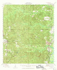
1943 Map of Citronelle
USGS Topo · Published 1960About this map
Citronelle stands as the primary hub of this 1940s Alabama interior, where the high pine lands of Mobile and Washington counties meet. The landscape is defined by a dense network of country schools and churches, including Sims Chapel Sch and Pleasant View Sch, reflecting a deeply established rural community before the mid-century. Along the eastern edge, the Mobile River provides a critical transport artery, bordered by the Southern railroad and settlements like Bucks and Chastang.
Find a feature on this map
73 named features on this map. Tap any name to fly to it.
Don’t see what you’re looking for? This feature index may not catch every label — zoom into the map to look around manually.
Map Details
Editions of this 1943 Citronelle Map
2 editions found
Other maps of this area

1941 · Bay Minette
USGS Topo · 1:62,500

1941 · Creola
USGS Topo · 1:62,500

1942 · Deer Park
USGS Topo · 1:62,500

1942 · Wilmer
USGS Topo · 1:62,500

1943 · Creola
USGS Topo · 1:62,500

1943 · Bay Minette
USGS Topo · 1:62,500

1943 · Deer Park
USGS Topo · 1:62,500

1943 · Choctaw Bluff
USGS Topo · 1:62,500

1943 · Tensaw
USGS Topo · 1:62,500

1943 · McIntosh
USGS Topo · 1:62,500