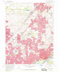
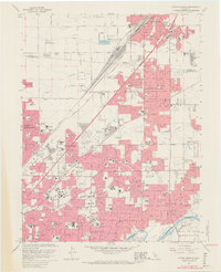
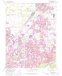
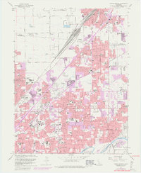
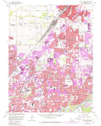
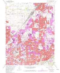
1967 Map of Citrus Heights
USGS Topo · Published 1969About this map
The suburban expansion of northeast Sacramento and southern Placer counties is caught in a moment of rapid development between Roseville and Carmichael. This area, historically anchored by the Southern Pacific rail corridor and the winding course of Dry Creek, shows the emergence of dense residential grids across Citrus Heights and North Highlands. The landscape is transitioning from open acreage to a built environment defined by major thoroughfares like Sunrise Blvd and Auburn Blvd.
Find a feature on this map
105 named features on this map. Tap any name to fly to it.
Don’t see what you’re looking for? This feature index may not catch every label — zoom into the map to look around manually.
Map Details
Editions of this 1967 Citrus Heights Map
6 editions found
Other maps of this area

1891 · Sacramento
USGS Topo · 1:125,000

1892 · Sacramento
USGS Topo · 1:125,000

1893 · Sacramento
USGS Topo · 1:125,000

1902 · Fairoaks
USGS Topo · 1:62,500

1908 · Buffalo Creek
USGS Topo · 1:31,680

1910 · Roseville
USGS Topo · 1:31,680

1910 · Pleasant Grove
USGS Topo · 1:31,680

1911 · Brighton
USGS Topo · 1:31,680

1911 · Mills
USGS Topo · 1:31,680

1911 · Arcade
USGS Topo · 1:31,680