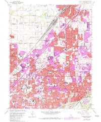
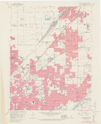
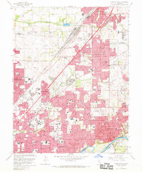
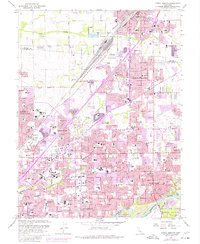
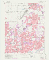
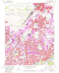
1967 Map of Citrus Heights
USGS Topo · Published 1984About this map
Citrus Heights and its neighboring suburbs north of the American River appear in a state of rapid post-war expansion. The map details the dense suburbanization stretching from North Highlands through Foothill Farms to Fair Oaks, centered around major transit corridors like Auburn Blvd and the Southern Pacific rail line. This era captures the significant investment in local education and community infrastructure, evidenced by dozens of local schools such as San Juan HS and American River College.
Find a feature on this map
87 named features on this map. Tap any name to fly to it.
Don’t see what you’re looking for? This feature index may not catch every label — zoom into the map to look around manually.
Map Details
Editions of this 1967 Citrus Heights Map
6 editions found
Other maps of this area

1891 · Sacramento
USGS Topo · 1:125,000

1892 · Sacramento
USGS Topo · 1:125,000

1893 · Sacramento
USGS Topo · 1:125,000

1902 · Fairoaks
USGS Topo · 1:62,500

1908 · Buffalo Creek
USGS Topo · 1:31,680

1910 · Roseville
USGS Topo · 1:31,680

1910 · Pleasant Grove
USGS Topo · 1:31,680

1911 · Brighton
USGS Topo · 1:31,680

1911 · Mills
USGS Topo · 1:31,680

1911 · Arcade
USGS Topo · 1:31,680