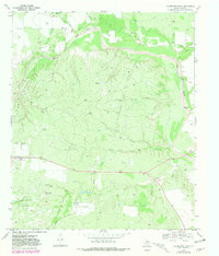
1969 Map of Clairemont East
USGS Topo · Published 1981About this map
Clairemont anchors this West Texas landscape, serving as a hub for the surrounding ranching and petroleum operations. The map documents the extensive infrastructure of the Clairemont Oil Field and Clairemont East Oil Field, where numerous wells and tanks are interspersed among the drainages of the Salt Fork Brazos River and Little Salt Fork Brazos River. The terrain is defined by rugged draws like Seven Section Draw and prominent landmarks such as Butte Knob. Cultural features like the County Fairground and Clairemont Cem provide points of interest for genealogists and local historians, while the O Bar O Ranch and its associated Landing Field illustrate the large-scale landholdings typical of the era. The drainage network, including Dry Duck Creek and Butte Creek, dictates the placement of the sparse road network in this cattle and oil country.
Find a feature on this map
21 named features on this map. Tap any name to fly to it.
Don’t see what you’re looking for? This feature index may not catch every label — zoom into the map to look around manually.
Map Details
Editions of this 1969 Clairemont East Map
2 editions found
Other maps of this area

1954 · Lubbock
USGS Topo · 1:250,000

1958 · Jayton
USGS Topo · 1:24,000

1959 · Girard
USGS Topo · 1:24,000

1968 · White Camp
USGS Topo · 1:24,000
1969 · A B C Creek
USGS Topo · 1:24,000

1969 · Cooper Mountain
USGS Topo · 1:24,000

1969 · Clairemont East
USGS Topo · 1:24,000

1969 · Clairemont West
USGS Topo · 1:24,000

1969 · Jayton South
USGS Topo · 1:24,000
1969 · Gant Hills
USGS Topo · 1:24,000