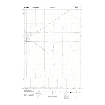
2010 Map of Clara City
USGS Topo · Published 2010About this map
Clara City serves as the primary hub of this prairie landscape at the start of the 2010s, defined by a rigid agricultural grid and the gentle meandering of Hawk Creek. The town is well-documented, showing the local Clara City Post Office and the Bethany Cemetery situated along its northern edge. Further east, the small settlement of Bunde sits at a crossroads, anchored by the Christian Reform Church Cemetery, illustrating the importance of these rural religious centers to the region's social geography. The landscape is dominated by section-line roads like 130th Ave SE and 50th St SE, which underscore the organized land division of Chippewa County. The southern portion of the map is marked by Chip Renville St Se, indicating the transition into the neighboring county through this predominantly farming territory.
Find a feature on this map
29 named features on this map. Tap any name to fly to it.
Don’t see what you’re looking for? This feature index may not catch every label — zoom into the map to look around manually.
Map Details
Editions of this 2010 Clara City Map
This is the sole edition of this map. No revisions or reprints were ever made.
Other maps of this area

1953 · New Ulm
USGS Topo · 1:250,000

1953 · Saint Cloud
USGS Topo · 1:250,000

1957 · Saint Cloud
USGS Topo · 1:250,000

1957 · New Ulm
USGS Topo · 1:250,000

1958 · New Ulm
USGS Topo · 1:250,000

1958 · Saint Cloud
USGS Topo · 1:250,000

1958 · Kerkhoven SE
USGS Topo · 1:24,000

1958 · Kerkhoven SW
USGS Topo · 1:24,000

1958 · Raymond
USGS Topo · 1:24,000
1965 · Maynard
USGS Topo · 1:24,000