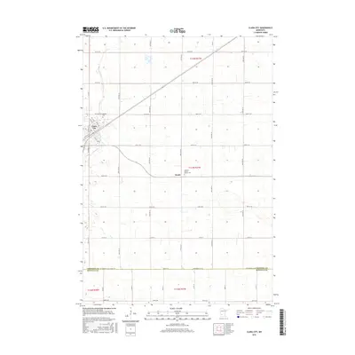
2016 Map of Clara City
USGS Topo · Published 2016About this map
Clara City serves as the primary hub of this agricultural landscape in West Central Minnesota, characterized by its strict section-line road grid and the winding path of Hawk Cr. This 2016 survey shows the town's detailed street plan, including Division St N, Center Ave W, and Watchler Ave, while the surrounding countryside is dotted with critical local landmarks for genealogists. Notable among these are the Bethany Cem north of town and the community of Bunde to the southeast, which is home to the Christian Reform Church. The map also clearly delineates the border between Chippewa Co and Renville Co, following the path of Chip-Renville St SE and 890th Ave. This layout illustrates a highly organized prairie settlement pattern where local life revolves around the intersection of county roads and drainage systems.
Find a feature on this map
42 named features on this map. Tap any name to fly to it.
Don’t see what you’re looking for? This feature index may not catch every label — zoom into the map to look around manually.
Map Details
Editions of this 2016 Clara City Map
This is the sole edition of this map. No revisions or reprints were ever made.
Other maps of this area

1953 · New Ulm
USGS Topo · 1:250,000

1953 · Saint Cloud
USGS Topo · 1:250,000

1957 · Saint Cloud
USGS Topo · 1:250,000

1957 · New Ulm
USGS Topo · 1:250,000

1958 · New Ulm
USGS Topo · 1:250,000

1958 · Saint Cloud
USGS Topo · 1:250,000

1958 · Kerkhoven SE
USGS Topo · 1:24,000

1958 · Kerkhoven SW
USGS Topo · 1:24,000

1958 · Raymond
USGS Topo · 1:24,000
1965 · Maynard
USGS Topo · 1:24,000