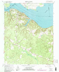
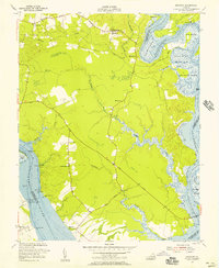
1966 Map of Claremont
USGS Topo · Published 1986About this map
The James River and its broad tidal confluence with the Chickahominy River dominate this landscape during the mid-1960s. Along the southern bluffs, the town of Claremont and the historic Claremont Manor overlook the water, marking a transition from the river-facing estates to the deeply wooded and swampy interiors of Surry County. The settlement pattern is defined by the high ground between the water and the low-lying reaches of Cypress Swamp and Spring Grove Swamp.
Find a feature on this map
37 named features on this map. Tap any name to fly to it.
Don’t see what you’re looking for? This feature index may not catch every label — zoom into the map to look around manually.
Map Details
Editions of this 1966 Claremont Map
4 editions found
Other maps of this area

1917 · Toano
USGS Topo · 1:62,500

1918 · Charles City
USGS Topo · 1:62,500

1918 · Toano
USGS Topo · 1:62,500

1919 · Surry
USGS Topo · 1:62,500

1919 · Disputanta
USGS Topo · 1:62,500

1943 · Savedge
USGS Topo · 1:31,680

1943 · Richmond
USGS Topo · 1:250,000

1944 · Waverly
USGS Topo · 1:31,680

1949 · Richmond
USGS Topo · 1:250,000
1952 · Brandon
USGS Topo · 1:24,000