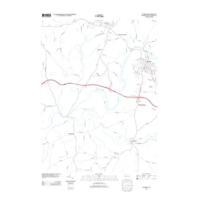
2013 Map of Clarion
USGS Topo · Published 2013About this map
The Clarion River winds deeply through this portion of Clarion County, anchoring a landscape where modern aviation and residential growth meet traditional Pennsylvania settlements. The borough of Clarion serves as the primary hub, showing a dense street grid that includes Madison St and Liberty St. Outside the main borough, the map reveals a constellation of smaller communities and crossroads, such as Marianne, Clarion Junction, and the southern village of Reidsburg.
Find a feature on this map
144 named features on this map. Tap any name to fly to it.
Don’t see what you’re looking for? This feature index may not catch every label — zoom into the map to look around manually.
Map Details
Editions of this 2013 Clarion Map
This is the sole edition of this map. No revisions or reprints were ever made.
Other maps of this area

1906 · Clarion
USGS Topo · 1:62,500

1907 · Clarion
USGS Topo · 1:62,500

1907 · Foxburg
USGS Topo · 1:62,500

1908 · Foxburg
USGS Topo · 1:62,500

1922 · Oil City
USGS Topo · 1:48,000

1922 · Tionesta
USGS Topo · 1:62,500

1924 · Oil City
USGS Topo · 1:62,500

1924 · Tionesta
USGS Topo · 1:62,500

1943 · Oil City
USGS Topo · 1:62,500

1946 · Tionesta
USGS Topo · 1:62,500