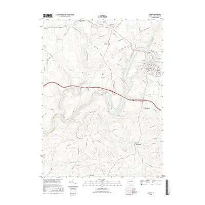
2016 Map of Clarion
USGS Topo · Published 2016About this map
The Clarion town site and the winding course of the Clarion River dominate this modern topographical record of Clarion County. The river, carved into the landscape, forms the central geographic artery, opening into the Piney Reservoir and passing through steep valley walls near Williamsburg. To the north, the elevation rises toward Huckleberry Ridge and Groce Hill, while the N Country National Scenic Trail traverses the northern woodlands, linking Shippenville with the community of Marianne. This 2016 survey provides a clear view of the regional infrastructure, from the Clarion County Airport and Rte 322 corridor to the localized road networks serving Shamburg and Reidsburg. Genealogists and local researchers will find the layout of the Clarion Cem and numerous named tributaries like Paint Cr and Brush Run invaluable for placing family land or historic events in context.
Find a feature on this map
21 named features on this map. Tap any name to fly to it.
Don’t see what you’re looking for? This feature index may not catch every label — zoom into the map to look around manually.
Map Details
Editions of this 2016 Clarion Map
This is the sole edition of this map. No revisions or reprints were ever made.
Other maps of this area

1906 · Clarion
USGS Topo · 1:62,500

1907 · Clarion
USGS Topo · 1:62,500

1907 · Foxburg
USGS Topo · 1:62,500

1908 · Foxburg
USGS Topo · 1:62,500

1922 · Oil City
USGS Topo · 1:48,000

1922 · Tionesta
USGS Topo · 1:62,500

1924 · Oil City
USGS Topo · 1:62,500

1924 · Tionesta
USGS Topo · 1:62,500

1943 · Oil City
USGS Topo · 1:62,500

1946 · Tionesta
USGS Topo · 1:62,500