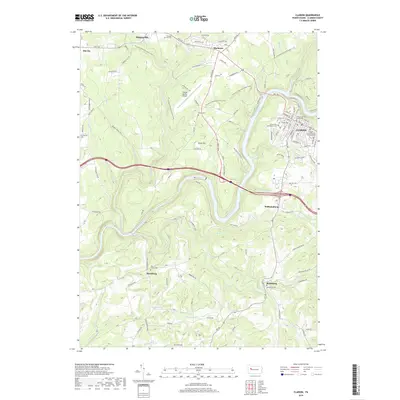
2019 Map of Clarion
USGS Topo · Published 2019About this map
The Clarion River carves a deep winding path through the center of this Pennsylvania landscape, serving as a primary geographic anchor for the county seat of Clarion. The borough is defined by its institutional landmarks, including the Clarion County Courthouse and the expansive grounds of Clarion University of Pennsylvania. This 2019 survey documents a mix of academic, civic, and natural spaces, where the modern Clarion County Airport and the wandering N Country National Scenic Trail intersect with older rural patterns.
Find a feature on this map
97 named features on this map. Tap any name to fly to it.
Don’t see what you’re looking for? This feature index may not catch every label — zoom into the map to look around manually.
Map Details
Editions of this 2019 Clarion Map
This is the sole edition of this map. No revisions or reprints were ever made.
Other maps of this area

1906 · Clarion
USGS Topo · 1:62,500

1907 · Clarion
USGS Topo · 1:62,500

1907 · Foxburg
USGS Topo · 1:62,500

1908 · Foxburg
USGS Topo · 1:62,500

1922 · Oil City
USGS Topo · 1:48,000

1922 · Tionesta
USGS Topo · 1:62,500

1924 · Oil City
USGS Topo · 1:62,500

1924 · Tionesta
USGS Topo · 1:62,500

1943 · Oil City
USGS Topo · 1:62,500

1946 · Tionesta
USGS Topo · 1:62,500