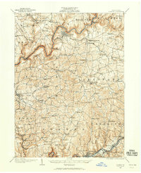
1906 Map of Clarion
USGS Topo · Published 1959About this map
Clarion serves as the central hub of this northern Pennsylvania landscape, situated high above the winding Clarion River. At the turn of the twentieth century, the region's economy is clearly defined by the intersection of natural resources and heavy infrastructure, notably the Pittsburgh Summerville and Clarion RR and the Baltimore and Ohio RR. Industrial activity is concentrated south of the river, where the Acme Mines and Jocelyn Mine operate near Rimersburg. The map reveals a high density of rural institutions, such as Concord Church and the County Home, alongside numerous neighborhood schoolhouses like Buckhorn School and Five Points School. The presence of small settlements like Shippenville and Strattonville suggests a well-distributed population connected by both water power at sites like Wilsons Mill and the emerging reach of the Sligo Branch railroad.
Find a feature on this map
120 named features on this map. Tap any name to fly to it.
Don’t see what you’re looking for? This feature index may not catch every label — zoom into the map to look around manually.
Map Details
Editions of this 1906 Clarion Map
2 editions found
Other maps of this area

1900 · Kittanning
USGS Topo · 1:62,500

1901 · Rural Valley
USGS Topo · 1:62,500

1902 · Kittanning
USGS Topo · 1:62,500

1903 · Rural Valley
USGS Topo · 1:62,500

1906 · Clarion
USGS Topo · 1:62,500

1907 · Clarion
USGS Topo · 1:62,500

1907 · Foxburg
USGS Topo · 1:62,500

1908 · Foxburg
USGS Topo · 1:62,500

1909 · Smicksburg
USGS Topo · 1:62,500

1918 · Loleta
USGS Topo · 1:62,500