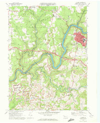
1969 Map of Clarion
USGS Topo · Published 1972About this map
The Clarion River winds through this 1969 landscape, carving a deep valley that separates the town of Clarion from the industrial and agricultural uplands of Beaver and Paint townships. The town itself serves as a regional hub, centered around the Clarion State College campus and anchored by civic landmarks like the Courthouse and Library near Main Street. This survey captures a moment when the region's extraction-based economy was highly visible, with numerous Strip Mine operations and gas wells dotting the plateaus above the river.
Find a feature on this map
57 named features on this map. Tap any name to fly to it.
Don’t see what you’re looking for? This feature index may not catch every label — zoom into the map to look around manually.
Map Details
Editions of this 1969 Clarion Map
2 editions found
Other maps of this area

1906 · Clarion
USGS Topo · 1:62,500

1907 · Clarion
USGS Topo · 1:62,500

1907 · Foxburg
USGS Topo · 1:62,500

1908 · Foxburg
USGS Topo · 1:62,500

1922 · Oil City
USGS Topo · 1:48,000

1922 · Tionesta
USGS Topo · 1:62,500

1924 · Oil City
USGS Topo · 1:62,500

1924 · Tionesta
USGS Topo · 1:62,500

1943 · Oil City
USGS Topo · 1:62,500

1946 · Tionesta
USGS Topo · 1:62,500