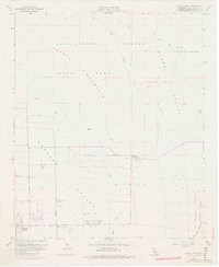
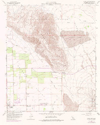
1959 Map of Clark Lake
USGS Topo · Published 1977About this map
Borrego Springs serves as the hub of development in this desert landscape, where civil infrastructure meets the arid expanse of Anza-Borrego Desert State Park. The map documents a transition from the agricultural and utility markers of the south, such as the Borrego School and Borrego Valley Substation, to the primitive routes of the north. Significant landforms like Coyote Mountain and the Borrego Badlands define the topography, while the ephemeral Clark Lake and isolated water sources like Clark Well indicate the critical role of hydrology in this environment.
Find a feature on this map
25 named features on this map. Tap any name to fly to it.
Don’t see what you’re looking for? This feature index may not catch every label — zoom into the map to look around manually.
Map Details
Editions of this 1959 Clark Lake Map
5 editions found
Other maps of this area

1904 · Indio
USGS Topo · 1:125,000

1931 · Vallecito
USGS Topo · 1:125,000

1939 · Borrego
USGS Topo · 1:62,500

1941 · Clark Lake
USGS Topo · 1:62,500

1942 · Barrel Spring
USGS Topo · 1:62,500

1942 · Agua Dulce
USGS Topo · 1:62,500

1942 · Clark Lake
USGS Topo · 1:62,500

1942 · Borego
USGS Topo · 1:62,500

1943 · Vallecito
USGS Topo · 1:125,000

1944 · Agua Dulce
USGS Topo · 1:62,500