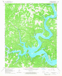
1965 Map of Clarkridge
USGS Topo · Published 1967About this map
Norfork Lake dominates the eastern half of this landscape, its deep, branching arms reaching into the rugged hills of northern Arkansas. Surveyed in the mid-1960s, the map illustrates a transition from upland farming to a water-focused geography, particularly around Mallard Point and Teal Point. The settlement of Clarkridge serves as a small hub for the surrounding ridges, which are dotted with family-named landmarks and rural institutions.
Find a feature on this map
38 named features on this map. Tap any name to fly to it.
Don’t see what you’re looking for? This feature index may not catch every label — zoom into the map to look around manually.
Map Details
Editions of this 1965 Clarkridge Map
4 editions found
Other maps of this area

1890 · Mountain Home
USGS Topo · 1:125,000

1891 · Mountain Home
USGS Topo · 1:125,000

1894 · Mountain Home
USGS Topo · 1:125,000

1934 · Gainesville
USGS Topo · 1:48,000

1940 · Gainesville
USGS Topo · 1:62,500

1944 · Cureall
USGS Topo · 1:62,500

1945 · Harrison
USGS Topo · 1:250,000

1946 · Cureall
USGS Topo · 1:62,500

1949 · Harrison
USGS Topo · 1:250,000

1954 · Harrison
USGS Topo · 1:250,000