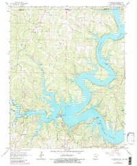
1965 Map of Clarkridge
USGS Topo · Published 1982About this map
The waters of Norfork Lake dominate this 1965 survey, reaching into the Ozark hills along the Missouri-Arkansas border. The map illustrates a landscape of deep-water fingers and winding shorelines, where the normal pool elevation defines a complex network of points and coves. Settlement is concentrated around the small community of Clarkridge, while local heritage is preserved in several rural burial grounds including Thacker Cem, Quality Ridge Cem, and Maynard Cem.
Find a feature on this map
37 named features on this map. Tap any name to fly to it.
Don’t see what you’re looking for? This feature index may not catch every label — zoom into the map to look around manually.
Map Details
Editions of this 1965 Clarkridge Map
4 editions found
Other maps of this area

1890 · Mountain Home
USGS Topo · 1:125,000

1891 · Mountain Home
USGS Topo · 1:125,000

1894 · Mountain Home
USGS Topo · 1:125,000

1934 · Gainesville
USGS Topo · 1:48,000

1940 · Gainesville
USGS Topo · 1:62,500

1944 · Cureall
USGS Topo · 1:62,500

1945 · Harrison
USGS Topo · 1:250,000

1946 · Cureall
USGS Topo · 1:62,500

1949 · Harrison
USGS Topo · 1:250,000

1954 · Harrison
USGS Topo · 1:250,000