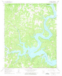
1965 Map of Clarkridge
USGS Topo · Published 1975About this map
Norfork Lake dominates this mid-1960s landscape, with its intricately branched shoreline reaching deep into the hollows of the Ozark plateau. At this time, the water level is recorded at Normal Pool Elevation 548, defining the geography around Teal Point and Mallard Point. The map illustrates the rural settlement patterns of the era, centered on the community of Clarkridge and various family-named landmarks.
Find a feature on this map
34 named features on this map. Tap any name to fly to it.
Don’t see what you’re looking for? This feature index may not catch every label — zoom into the map to look around manually.
Map Details
Editions of this 1965 Clarkridge Map
4 editions found
Other maps of this area

1890 · Mountain Home
USGS Topo · 1:125,000

1891 · Mountain Home
USGS Topo · 1:125,000

1894 · Mountain Home
USGS Topo · 1:125,000

1934 · Gainesville
USGS Topo · 1:48,000

1940 · Gainesville
USGS Topo · 1:62,500

1944 · Cureall
USGS Topo · 1:62,500

1945 · Harrison
USGS Topo · 1:250,000

1946 · Cureall
USGS Topo · 1:62,500

1949 · Harrison
USGS Topo · 1:250,000

1954 · Harrison
USGS Topo · 1:250,000