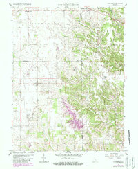
1958 Map of Clarksburg
USGS Topo · Published 1988About this map
The sprawling waters of Lake Santee anchor the southern portion of this landscape, a significant modern addition to the terrain revisions shown in purple on this mid-century survey. The area transitions from the relatively level agricultural lands of Richland and Fugit townships in the west toward the increasingly dissected drainages of Salt Creek and its many branches in the east. Small rural centers like Clarksburg and Andersonville provide historical focal points, while the distribution of sites such as Hopewell Ch and Township Sch reflects the traditional social structure of the Indiana countryside.
Find a feature on this map
28 named features on this map. Tap any name to fly to it.
Don’t see what you’re looking for? This feature index may not catch every label — zoom into the map to look around manually.
Map Details
Editions of this 1958 Clarksburg Map
4 editions found
Other maps of this area

1946 · Batesville
USGS Topo · 1:24,000

1946 · New Point
USGS Topo · 1:24,000

1953 · Cincinnati
USGS Topo · 1:250,000

1956 · Alpine
USGS Topo · 1:24,000

1956 · Metamora
USGS Topo · 1:24,000

1957 · Cincinnati
USGS Topo · 1:250,000

1958 · Greensburg
USGS Topo · 1:24,000

1958 · Clarksburg
USGS Topo · 1:24,000

1959 · Milroy
USGS Topo · 1:24,000

1959 · Rushville
USGS Topo · 1:24,000