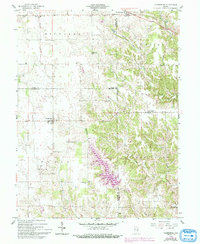
1958 Map of Clarksburg
USGS Topo · Published 1993About this map
Clarksburg anchors this southeastern Indiana landscape, where the agricultural plains of Richland and Fugit townships meet the dissected valleys of the Salt Creek drainage system. A significant shift in the terrain is marked by the presence of Lake Santee, a large man-made reservoir that dominates the southern portion of the map, fed by the Right hand Fork and the Bull Fork. While the western half of the map features a regular grid of rural roads and homesteads, the eastern side follows the winding courses of the South Fork Salt Creek and Little Salt Creek, where topography becomes more complex.
Find a feature on this map
24 named features on this map. Tap any name to fly to it.
Don’t see what you’re looking for? This feature index may not catch every label — zoom into the map to look around manually.
Map Details
Editions of this 1958 Clarksburg Map
4 editions found
Other maps of this area

1946 · Batesville
USGS Topo · 1:24,000

1946 · New Point
USGS Topo · 1:24,000

1953 · Cincinnati
USGS Topo · 1:250,000

1956 · Alpine
USGS Topo · 1:24,000

1956 · Metamora
USGS Topo · 1:24,000

1957 · Cincinnati
USGS Topo · 1:250,000

1958 · Greensburg
USGS Topo · 1:24,000

1958 · Clarksburg
USGS Topo · 1:24,000

1959 · Milroy
USGS Topo · 1:24,000

1959 · Rushville
USGS Topo · 1:24,000