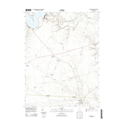
2013 Map of Clarksburg
USGS Topo · Published 2013About this map
Agricultural lands along the Pickaway Co Ross Co line define this portion of the Scioto River valley, where small communities and family farms are connected by a network of state routes and country roads. The village of Clarksburg sits at the southern edge, serving as a local hub with its Clarksburg Methodist Cem and proximity to Plum Run. Moving north, the landscape is punctuated by numerous family-named burial grounds, such as the Arron Kellar Farm Cem and Grant Campbell Farm Cem, which offer significant value for genealogical research. The northern boundary is marked by the recreational and water resources of Deer Cr Lake and the former site of Crownover Mill. Transportation through the region centers on the intersection at Kozy Corners and the community of Atlanta, while Williamsport occupies the eastern territory near Dry Run.
Find a feature on this map
80 named features on this map. Tap any name to fly to it.
Don’t see what you’re looking for? This feature index may not catch every label — zoom into the map to look around manually.
Map Details
Editions of this 2013 Clarksburg Map
This is the sole edition of this map. No revisions or reprints were ever made.
Other maps of this area

1906 · Mt Sterling
USGS Topo · 1:62,500

1911 · Era
USGS Topo · 1:62,500

1912 · Roxabell
USGS Topo · 1:62,500

1913 · Era
USGS Topo · 1:62,500

1914 · Roxabell
USGS Topo · 1:62,500

1917 · Greenfield
USGS Topo · 1:62,500

1943 · Era
USGS Topo · 1:62,500

1944 · Greenfield
USGS Topo · 1:62,500

1944 · Roxabell
USGS Topo · 1:62,500

1947 · Columbus
USGS Topo · 1:250,000