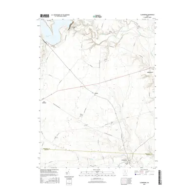
2016 Map of Clarksburg
USGS Topo · Published 2016About this map
Crownover Mill sits along the winding course of Deer Creek, anchoring a landscape defined by small crossroads settlements and a high density of family farm burial grounds. This 2016 survey of the border between Pickaway and Ross Counties reveals a rural infrastructure where township roads and pikes connect villages like Atlanta, Williamsport, and Clarksburg. The northern reaches are dominated by the waters of Deer Creek Lake, while the agricultural plains to the south are drained by numerous small runs and creeks, including Plum Run and Hay Run. Genealogists will find this sheet particularly valuable for its documentation of numerous isolated family cemeteries, such as the Arron Kellar Farm Cem, Lewis Farm Cem, and Grant Campbell Farm Cem, which are scattered across the private farmsteads between New Holland and the county line.
Find a feature on this map
61 named features on this map. Tap any name to fly to it.
Don’t see what you’re looking for? This feature index may not catch every label — zoom into the map to look around manually.
Map Details
Editions of this 2016 Clarksburg Map
This is the sole edition of this map. No revisions or reprints were ever made.
Other maps of this area

1906 · Mt Sterling
USGS Topo · 1:62,500

1911 · Era
USGS Topo · 1:62,500

1912 · Roxabell
USGS Topo · 1:62,500

1913 · Era
USGS Topo · 1:62,500

1914 · Roxabell
USGS Topo · 1:62,500

1917 · Greenfield
USGS Topo · 1:62,500

1943 · Era
USGS Topo · 1:62,500

1944 · Greenfield
USGS Topo · 1:62,500

1944 · Roxabell
USGS Topo · 1:62,500

1947 · Columbus
USGS Topo · 1:250,000