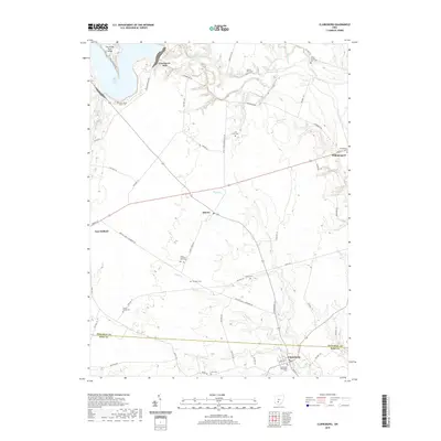
2019 Map of Clarksburg
USGS Topo · Published 2019About this map
The agricultural landscape of the Pickaway and Ross County border is defined by the winding course of Deer Creek, which feeds into Deer Creek Lake in the northwest. This area maintains a strong connection to its 19th-century settlement patterns, evidenced by numerous small family burial grounds scattered across the terrain, including the Hinton Farm Cem, Arron Kellar Farm Cem, and Arthur Dunlap Farm Cem. The map provides a detailed look at the local road network that connects several established villages, such as Clarksburg, Williamsport, and Atlanta.
Find a feature on this map
62 named features on this map. Tap any name to fly to it.
Don’t see what you’re looking for? This feature index may not catch every label — zoom into the map to look around manually.
Map Details
Editions of this 2019 Clarksburg Map
This is the sole edition of this map. No revisions or reprints were ever made.
Other maps of this area

1906 · Mt Sterling
USGS Topo · 1:62,500

1911 · Era
USGS Topo · 1:62,500

1912 · Roxabell
USGS Topo · 1:62,500

1913 · Era
USGS Topo · 1:62,500

1914 · Roxabell
USGS Topo · 1:62,500

1917 · Greenfield
USGS Topo · 1:62,500

1943 · Era
USGS Topo · 1:62,500

1944 · Greenfield
USGS Topo · 1:62,500

1944 · Roxabell
USGS Topo · 1:62,500

1947 · Columbus
USGS Topo · 1:250,000