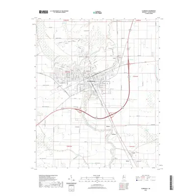
2020 Map of Clarksdale
USGS Topo · Published 2020About this map
The Big Sunflower River winds through the heart of the Mississippi Delta here, shaping the development of Clarksdale and its surrounding agricultural communities. The town layout is anchored by the Coahoma County Courthouse, with a dense street grid that reflects its role as a regional hub. To the north, the smaller settlement of Lyon is joined by the outlying hamlets of Hopson, Durham, and Lurand to the south, highlighting the cluster of communities that grew along the fertile riverbanks and early transit routes.
Find a feature on this map
148 named features on this map. Tap any name to fly to it.
Don’t see what you’re looking for? This feature index may not catch every label — zoom into the map to look around manually.
Map Details
Editions of this 2020 Clarksdale Map
This is the sole edition of this map. No revisions or reprints were ever made.
Other maps of this area

1908 · Coahoma
USGS Topo · 1:24,000

1908 · Jonestown
USGS Topo · 1:24,000

1910 · Coahoma
USGS Topo · 1:31,680

1910 · Jonestown
USGS Topo · 1:31,680

1932 · Tutwiler
USGS Topo · 1:48,000

1932 · Marks
USGS Topo · 1:48,000

1935 · Clarksdale
USGS Topo · 1:62,500

1935 · Marks
USGS Topo · 1:62,500

1935 · Tutwiler
USGS Topo · 1:62,500

1939 · Farrell
USGS Topo · 1:62,500