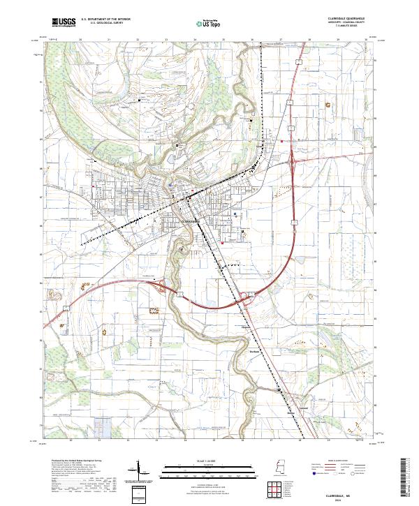
2024 Map of Clarksdale
USGS Topo · Published 2024About this map
Clarksdale serves as the focal point of this Delta landscape, centered around the Coahoma County Courthouse. The city's grid extends across the Big Sunflower River, which meanders south through the heart of the region. This survey captures the spatial relationship between the urban center and its outlying agricultural hamlets, including Lyon to the northeast and Hopson and Durham to the south. Numerous community landmarks are noted throughout the rural areas, particularly family and church burial sites such as Saint James Cem and Hackberry Cem. The drainage patterns of the Mississippi Delta are clearly defined by features like Sandy Bayou, Mill Creek, and Kay Bayou, illustrating the complex water network that supported the local cotton-growing economy.
Find a feature on this map
156 named features on this map. Tap any name to fly to it.
Don’t see what you’re looking for? This feature index may not catch every label — zoom into the map to look around manually.
Map Details
Editions of this 2024 Clarksdale Map
This is the sole edition of this map. No revisions or reprints were ever made.
Other maps of this area

1908 · Coahoma
USGS Topo · 1:24,000

1908 · Jonestown
USGS Topo · 1:24,000

1910 · Coahoma
USGS Topo · 1:31,680

1910 · Jonestown
USGS Topo · 1:31,680

1932 · Tutwiler
USGS Topo · 1:48,000

1932 · Marks
USGS Topo · 1:48,000

1935 · Clarksdale
USGS Topo · 1:62,500

1935 · Marks
USGS Topo · 1:62,500

1935 · Tutwiler
USGS Topo · 1:62,500

1939 · Farrell
USGS Topo · 1:62,500