Loading...
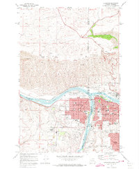
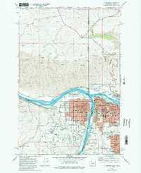
Loading map...1971 Map of Clarkston
USGS Topo · Published 1974About this map
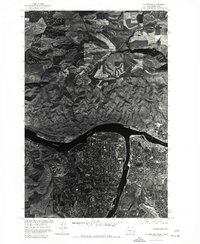
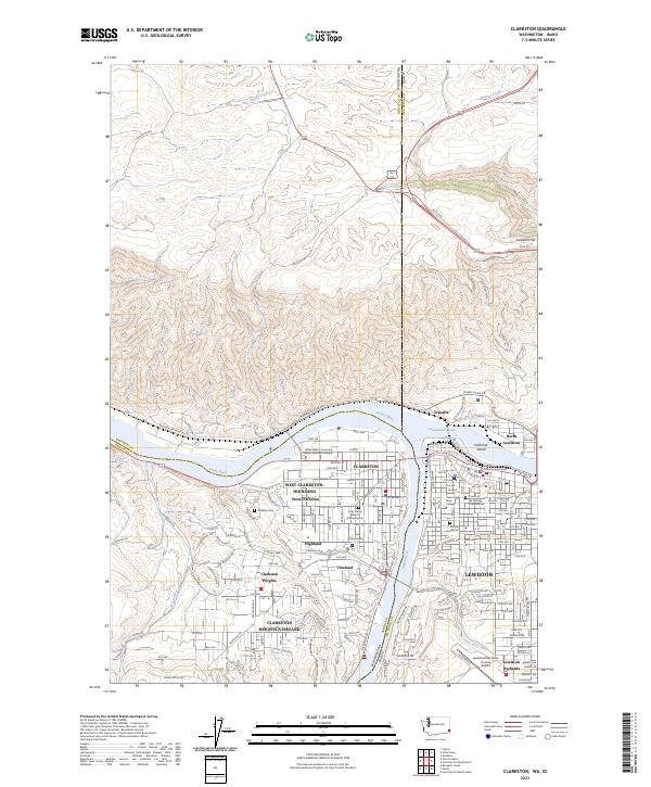
The confluence of the Snake River and Clearwater River serves as the focal point for this 1971 study of the border region between Washington and Idaho. The twin cities of Clarkston and Lewiston are shown in high detail, revealing a mid-century urban landscape defined by educational institutions and transportation infrastructure. Notable local landmarks include Lewis-Clark State College, St Stanislaus Sch, and the North Idaho Childrens Home, reflecting the established community centers of the era.
Find a feature on this map
76 named features on this map. Tap any name to fly to it.
Don’t see what you’re looking for? This feature index may not catch every label — zoom into the map to look around manually.
Map Details
Date Portrayed1971
Date Published1974
PublisherU.S. Geological Survey
Map TypeTopographic
Scale1:24,000
Physical Dimensions22.1 x 26.9 inches
Editions of this 1971 Clarkston Map
2 editions found
Historical Maps of Lewiston Through Time
6 maps found


Featured Locations
Source Details
SourceU.S. Geological Survey
CopyrightPublic Domain