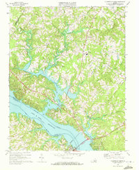
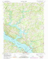
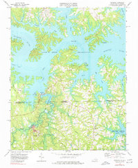
1968 Map of Clarksville North
USGS Topo · Published 1972This historical map portrays the area of Clarksville North in 1968, primarily covering Mecklenburg County as well as portions of Charlotte County and Halifax County. Featuring a scale of 1:24000, this map provides a highly detailed snapshot of the terrain, roads, buildings, counties, and historical landmarks in the Clarksville North region at the time. Published in 1972, it is one of 4 known editions of this map due to revisions or reprints.
Find a feature on this map
38 named features on this map. Tap any name to fly to it.
Don’t see what you’re looking for? This feature index may not catch every label — zoom into the map to look around manually.
Map Details
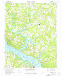
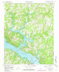
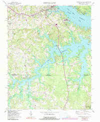
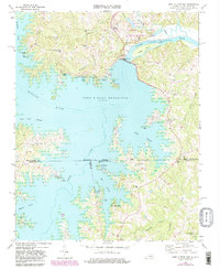
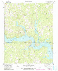
Editions of this 1968 Clarksville North Map
4 editions found
Historical Maps of Mooresville Estates Through Time
10 maps found
1966 Wightman
Mecklenburg County, VA
1968 Clarksville North
Mecklenburg County, VA
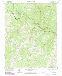
1968 Clarksville South
Mecklenburg County, VA
1968 John H Kerr Dam
Mecklenburg County, VA

1968 Nelson
Mecklenburg County, VA
1968 South Hill SE
Mecklenburg County, VA
1968 Tungsten
Mecklenburg County, VA
1977 Clarksville South
Mecklenburg County, VA
1977 John H Kerr Dam
Mecklenburg County, VA
1977 South Hill SE
Mecklenburg County, VA