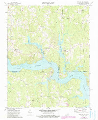
1968 Map of South Hill SE
USGS Topo · Published 1990About this map
Lake Gaston dominates this 1968 landscape, marking a period of significant hydroelectric and recreational development along the Roanoke River. The reservoir straddles the state line between Virginia and North Carolina, creating an intricate shoreline that flooded many former low-lying fields. On the northern banks, the community of Joyceville serves as a hub near the Siouan Scout Reservation, while several smaller rural crossings like Barker Crossroads and Five Forks define the upland road network.
Find a feature on this map
36 named features on this map. Tap any name to fly to it.
Don’t see what you’re looking for? This feature index may not catch every label — zoom into the map to look around manually.
Map Details
Editions of this 1968 South Hill SE Map
3 editions found

Other maps of this area

1919 · White Plains
USGS Topo · 1:48,000

1920 · White Plains
USGS Topo · 1:62,500

1953 · Norfolk
USGS Topo · 1:250,000

1953 · Greensboro
USGS Topo · 1:250,000

1954 · Greensboro
USGS Topo · 1:250,000

1962 · Greensboro
USGS Topo · 1:250,000

1963 · Gasburg
USGS Topo · 1:24,000

1963 · White Plains
USGS Topo · 1:24,000

1966 · Greensboro
USGS Topo · 1:250,000

1968 · South Hill SE
USGS Topo · 1:24,000