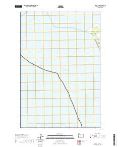
2020 Map of Clatsop Spit
USGS Topo · Published 2020About this map
Clatsop Spit dominates the northern edge of this coastal survey, marking the strategic entrance to the Columbia River. The map focus is largely maritime, documenting the vast expanse of the Pacific Ocean and the shifting sands of Social Security Beach. Navigational features are prominent, including the Entrance Range and the Lower Desdemona Shoal, which highlight the importance of maritime safety in these waters. On land, Jetty Rd provides the primary access along the narrow finger of the spit. This modern cartographic study uses township and range divisions to delineate the offshore and coastal boundaries, emphasizing the intersection of public land surveys with the dynamic Oregon shoreline.
Find a feature on this map
46 named features on this map. Tap any name to fly to it.
Don’t see what you’re looking for? This feature index may not catch every label — zoom into the map to look around manually.
Map Details
Editions of this 2020 Clatsop Spit Map
This is the sole edition of this map. No revisions or reprints were ever made.
Other maps of this area

1919 · Astoria
USGS Topo · 1:62,500

1938 · Cape Disappointment
USGS Topo · 1:62,500

1938 · Fort Columbia
USGS Topo · 1:62,500

1939 · Astoria
USGS Topo · 1:62,500

1943 · Fort Columbia
USGS Topo · 1:62,500

1943 · Copalis Beach
USGS Topo · 1:250,000

1949 · Chinook
USGS Topo · 1:24,000

1949 · Gearhart
USGS Topo · 1:24,000
1949 · Cape Disappointment
USGS Topo · 1:24,000

1951 · Copalis Beach
USGS Topo · 1:250,000