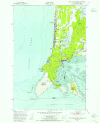
1949 Map of Cape Disappointment
USGS Topo · Published 1955About this map
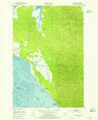
Cape Disappointment and the strategic mouth of the Columbia River dominate this coastal survey. The landscape is defined by its maritime and military significance, featuring both the North Head Lighthouse and the Cape Disappointment Lighthouse guarding the treacherous approach to Baker Bay. Inland, the peninsula's early development is visible through a string of settlements including Long Beach, Seaview, and the hub at Ilwaco.
Find a feature on this map
50 named features on this map. Tap any name to fly to it.
Don’t see what you’re looking for? This feature index may not catch every label — zoom into the map to look around manually.
Map Details
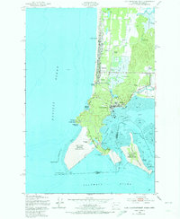
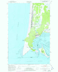
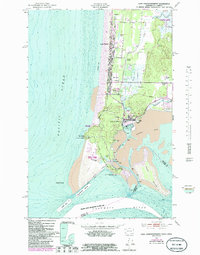
Editions of this 1949 Cape Disappointment Map
4 editions found
Other maps of this area

1919 · Astoria
USGS Topo · 1:62,500

1938 · Cape Disappointment
USGS Topo · 1:62,500

1938 · Fort Columbia
USGS Topo · 1:62,500

1939 · Astoria
USGS Topo · 1:62,500

1943 · Fort Columbia
USGS Topo · 1:62,500

1943 · Copalis Beach
USGS Topo · 1:250,000
1949 · Chinook
USGS Topo · 1:24,000
1949 · Ocean Park
USGS Topo · 1:24,000
1949 · Long Island
USGS Topo · 1:24,000

1951 · Copalis Beach
USGS Topo · 1:250,000