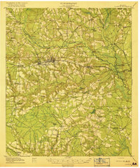
1919 Map of Claxton
USGS Topo · Published 1919About this map
Claxton serves as the central hub of this 1918 survey, where the Seaboard Air Line intersects with the Georgia and Florida Line. This era reveals a landscape dense with rural infrastructure, particularly a notable concentration of small community schools such as Liberia School, Brewton Mill School, and Mendes School. The Canoochee River winds through the northern half of the region, its passage marked by numerous named crossings like Mose Hendrix Bridge and Rogers Bridge. These river crossings and the rail sidings at Clarks Siding and Moodys Crossing illustrate the early 20th-century dependence on specific transit points for the local economy. Further south, the map documents a segment of the Georgia and Florida (Abandoned) rail line near Jennie, offering a distinct look at the shifting transportation priorities of the coastal plain just after the First World War.
Find a feature on this map
76 named features on this map. Tap any name to fly to it.
Don’t see what you’re looking for? This feature index may not catch every label — zoom into the map to look around manually.
Map Details
Editions of this 1919 Claxton Map
3 editions found
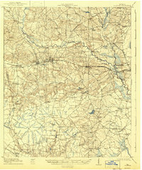
Other maps of this area

1918 · Hinesville
USGS Topo · 1:62,500

1919 · Claxton
USGS Topo · 1:62,500

1920 · Pembroke
USGS Topo · 1:62,500

1920 · Statesboro
USGS Topo · 1:62,500

1920 · Glennville
USGS Topo · 1:62,500

1921 · Brooklet
USGS Topo · 1:62,500

1943 · Brooklet
USGS Topo · 1:62,500

1943 · Statesboro
USGS Topo · 1:62,500

1944 · Claxton
USGS Topo · 1:62,500

1944 · Glennville
USGS Topo · 1:62,500