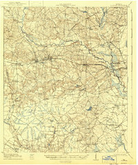
1919 Map of Claxton
USGS Topo · Published 1943About this map
Claxton and Hagan serve as central hubs in this early 20th-century Georgia landscape, where the Seaboard Air Line and Georgia and Florida RR intersect. The surveying reveals a rural society deeply invested in local education, evidenced by a high density of neighborhood institutions like Brewton Mill School, Cherry Grove School, and Liberia School. The Canoochee River winds through the northern and eastern sections, crossed by numerous family-named landmarks including Brewton Bridge and Mose Hendrix Bridge. South of the main towns, the Lumber RR and its Boundary Line branch cut through the timberlands, connecting small stops like Clarks Siding and Jennie. This documentation captures the area before modern highway expansion, preserving the locations of vanished rural schoolhouses and the specific paths of narrow-gauge logging rails that once drove the local economy.
Find a feature on this map
68 named features on this map. Tap any name to fly to it.
Don’t see what you’re looking for? This feature index may not catch every label — zoom into the map to look around manually.
Map Details
Editions of this 1919 Claxton Map
3 editions found
Other maps of this area

1918 · Hinesville
USGS Topo · 1:62,500

1919 · Claxton
USGS Topo · 1:62,500

1920 · Pembroke
USGS Topo · 1:62,500

1920 · Statesboro
USGS Topo · 1:62,500

1920 · Glennville
USGS Topo · 1:62,500

1921 · Brooklet
USGS Topo · 1:62,500

1943 · Brooklet
USGS Topo · 1:62,500

1943 · Statesboro
USGS Topo · 1:62,500

1944 · Claxton
USGS Topo · 1:62,500

1944 · Glennville
USGS Topo · 1:62,500