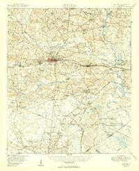
1950 Map of Claxton
USGS Topo · Published 1950About this map
Claxton serves as the central hub of this mid-century Evans County landscape, where the Seaboard Air Line railroad dictates the orientation of towns like Hagan and Daisy. The settlement pattern reflects a deeply rooted agrarian economy, evidenced by the high density of family cemeteries such as the Waters-Burkhalter Cem and Rogers Cem, and local institutions like the County Training School. To the north, the Canoochee River and its numerous tributaries feed a network of private ponds including Sikes Pond and Lewis Pond, while the southern portion of the map is dominated by the northern reaches of the Camp Stewart Military Reservation.
Find a feature on this map
101 named features on this map. Tap any name to fly to it.
Don’t see what you’re looking for? This feature index may not catch every label — zoom into the map to look around manually.
Map Details
Editions of this 1950 Claxton Map
2 editions found

Other maps of this area

1918 · Hinesville
USGS Topo · 1:62,500

1919 · Claxton
USGS Topo · 1:62,500

1920 · Pembroke
USGS Topo · 1:62,500

1920 · Statesboro
USGS Topo · 1:62,500

1920 · Glennville
USGS Topo · 1:62,500

1921 · Brooklet
USGS Topo · 1:62,500

1943 · Brooklet
USGS Topo · 1:62,500

1943 · Statesboro
USGS Topo · 1:62,500

1944 · Claxton
USGS Topo · 1:62,500

1944 · Glennville
USGS Topo · 1:62,500