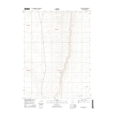
2015 Map of Clay Buttes SE
USGS Topo · Published 2015About this map
White Mtn dominates the central topography of this Sweetwater County landscape, where the high desert terrain is carved by seasonal drainage systems. The survey details the path of Old Highway 191 as it cuts north-south through the western sections, providing a critical transportation link through this arid region. To the south, the Chilton Cutoff Rd intersects the area near the headwaters of Fourteenmile Cr. The map captures a complex network of ephemeral waterways including Alkali Cr and Killpecker Cr, which define the erosion patterns leading into Long Canyon. These features illustrate the remote character of the Wyoming high plains, where modern infrastructure follows established paths through significant geological formations.
Find a feature on this map
11 named features on this map. Tap any name to fly to it.
Don’t see what you’re looking for? This feature index may not catch every label — zoom into the map to look around manually.
Map Details
Editions of this 2015 Clay Buttes SE Map
This is the sole edition of this map. No revisions or reprints were ever made.
Other maps of this area

1908 · Rock Springs
USGS Topo · 1:62,500

1910 · Rock Springs
USGS Topo · 1:62,500

1954 · Rock Springs
USGS Topo · 1:250,000

1958 · Rock Springs
USGS Topo · 1:250,000

1958 · Boars Tusk
USGS Topo · 1:62,500

1961 · Scott Spring
USGS Topo · 1:24,000

1961 · Pilot Butte
USGS Topo · 1:24,000

1962 · Rock Springs
USGS Topo · 1:250,000

1968 · Clay Buttes
USGS Topo · 1:24,000

1968 · White Rocks
USGS Topo · 1:24,000