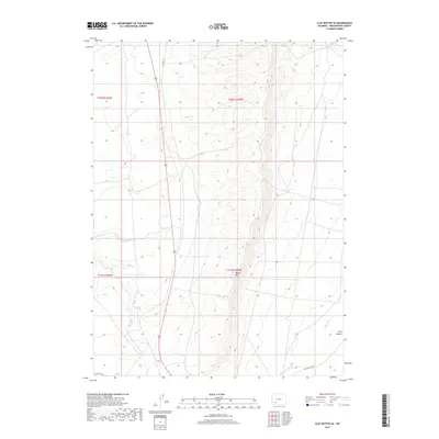
2017 Map of Clay Buttes SE
USGS Topo · Published 2017About this map
Alkali Creek and Killpecker Creek define the arid drainage patterns of this Sweetwater County landscape, which remains largely open and undeveloped into the early 21st century. The terrain is marked by the deep cut of Long Canyon to the southeast, while the southern boundary is traced by the seasonal flow of Fourteenmile Creek. This survey captures a section of the high desert where modern infrastructure is sparse, consisting primarily of section lines and the occasional local road crossing the high-plateau environment. The dominance of intermittent waterways like Alkali Creek highlights the characteristic hydrology of the Wyoming basin, where water courses are vital geographic markers across an otherwise broad and undulating expanse.
Find a feature on this map
8 named features on this map. Tap any name to fly to it.
Don’t see what you’re looking for? This feature index may not catch every label — zoom into the map to look around manually.
Map Details
Editions of this 2017 Clay Buttes SE Map
This is the sole edition of this map. No revisions or reprints were ever made.
Other maps of this area

1908 · Rock Springs
USGS Topo · 1:62,500

1910 · Rock Springs
USGS Topo · 1:62,500

1954 · Rock Springs
USGS Topo · 1:250,000

1958 · Rock Springs
USGS Topo · 1:250,000

1958 · Boars Tusk
USGS Topo · 1:62,500

1961 · Scott Spring
USGS Topo · 1:24,000

1961 · Pilot Butte
USGS Topo · 1:24,000

1962 · Rock Springs
USGS Topo · 1:250,000

1968 · Clay Buttes
USGS Topo · 1:24,000

1968 · White Rocks
USGS Topo · 1:24,000