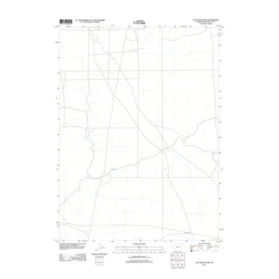
2012 Map of Clay Buttes SW
USGS Topo · Published 2012About this map
Alkali Creek winds through this arid expanse of Sweetwater County, forming the primary drainage system in a landscape defined by its open terrain and isolated infrastructure. Modern access to the region is anchored by the presence of 14 Mile Rd, which skirts the southern boundary. This 2012 survey by the U.S. Geological Survey reflects the high desert environment of southwestern Wyoming, where seasonal watercourses like the creek dictate the local geography. The map provides a clear record of the section lines and topography as they existed in the early 21st century, serving as a baseline for understanding the physical layout of this sparsely settled area.
Find a feature on this map
2 named features on this map. Tap any name to fly to it.
Don’t see what you’re looking for? This feature index may not catch every label — zoom into the map to look around manually.
Map Details
Editions of this 2012 Clay Buttes SW Map
This is the sole edition of this map. No revisions or reprints were ever made.
Other maps of this area

1954 · Rock Springs
USGS Topo · 1:250,000

1958 · Rock Springs
USGS Topo · 1:250,000

1961 · Scott Spring
USGS Topo · 1:24,000

1961 · Pilot Butte
USGS Topo · 1:24,000

1961 · Austin Ranch
USGS Topo · 1:24,000

1962 · Rock Springs
USGS Topo · 1:250,000

1963 · Pittman Well
USGS Topo · 1:24,000
1963 · Chrisman Ranch
USGS Topo · 1:24,000

1968 · Clay Buttes
USGS Topo · 1:24,000

1968 · White Rocks
USGS Topo · 1:24,000