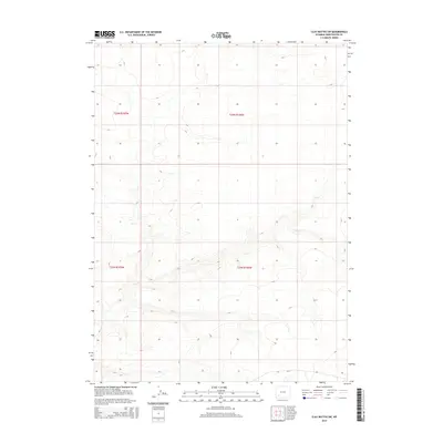
2015 Map of Clay Buttes SW
USGS Topo · Published 2015About this map
Alkali Creek drains this high plains portion of Sweetwater County, winding through a landscape defined by the Public Land Survey System grids of t21n r106w and t22n r106w. The topography is documented in fine detail by the U.S. Geological Survey, showing the gradual elevation shifts across this sparse terrain. Human presence is light, primarily represented by the corridor of Cr-14 in the southern sections. This map serves as a precise record of the natural drainage patterns and the established township and range boundaries that have governed land division in this part of Wyoming for generations.
Find a feature on this map
6 named features on this map. Tap any name to fly to it.
Don’t see what you’re looking for? This feature index may not catch every label — zoom into the map to look around manually.
Map Details
Editions of this 2015 Clay Buttes SW Map
This is the sole edition of this map. No revisions or reprints were ever made.
Other maps of this area

1954 · Rock Springs
USGS Topo · 1:250,000

1958 · Rock Springs
USGS Topo · 1:250,000

1961 · Scott Spring
USGS Topo · 1:24,000

1961 · Pilot Butte
USGS Topo · 1:24,000

1961 · Austin Ranch
USGS Topo · 1:24,000

1962 · Rock Springs
USGS Topo · 1:250,000

1963 · Pittman Well
USGS Topo · 1:24,000
1963 · Chrisman Ranch
USGS Topo · 1:24,000

1968 · Clay Buttes
USGS Topo · 1:24,000

1968 · White Rocks
USGS Topo · 1:24,000